China launches three commercial remote sensing satellites


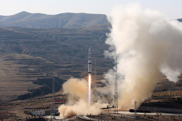 |
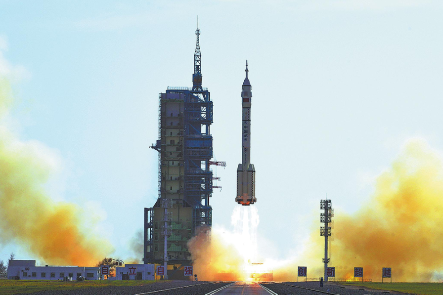
| A Long March-6 rocket carries three satellites into space from Taiyuan Satellite Launch Center in North China's Shanxi province, Nov 21, 2017. [Photo/Xinhua] |
TAIYUAN -- China launched three remote sensing satellites at 12:50 pm Tuesday from Taiyuan Satellite Launch Center in North China's Shanxi province.
The three satellites -- Jilin-1 04, Jilin-1 05 and Jilin-1 06 -- carried cameras designed to improve observation capability to promote commercial use for the remote sensing industry.
It was the third launch of the Jilin-1 satellite family, a remote sensing system of more than 60 satellites developed by Chang Guang Satellite Technology Co Ltd.
The system will be used for wide imaging, video imaging and multispectral imaging. Remote sensing data will serve administrations and commercial customers.
Tuesday's satellites were carried by a Long March-6 rocket, a new generation of China's liquid-fueled carrier rocket developed by China Aerospace Science and Technology Corporation.
The launch is the second mission of the Long March-6 and the 255th flight carried out with the Long-March series of carrier rockets.


- Wave of freezing weather brings snow to northern China
- APEC 'China Year' kicks off at Shenzhen meeting
- HKSAR chief executive says to conclude residential complex fire probe within 9 months
- Viral scenic valley in China, not Japan, operators of tourist attraction clarify
- European Chamber Shanghai Chapter calls for stronger EU-China sustainability ties
- Former senior official at State Council body under investigation