Chinese engineers make sci-fi drone mapping reality
Share - WeChat


A scene from the science fiction film Prometheus, where explorers deploy a mini-drone that laser-scans caves to generate 3D models instantly, has turned into reality, thanks to the efforts of Chinese engineers.
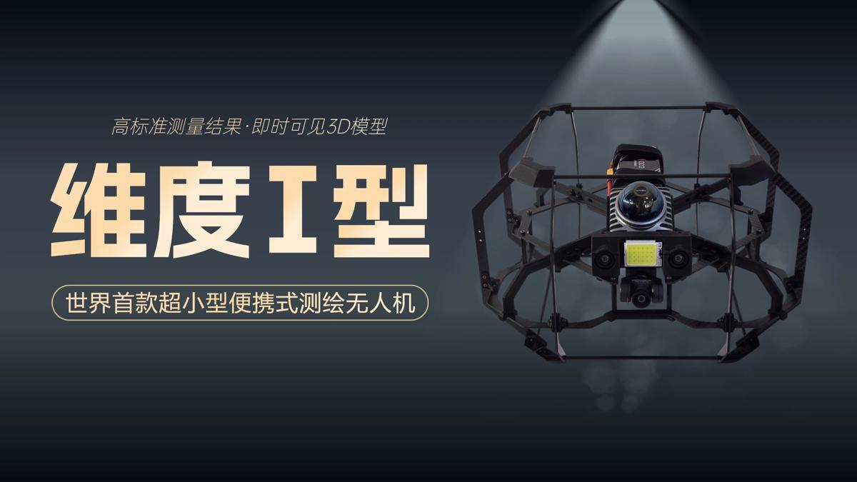
On Tuesday, the Spatiotemporal AI Perception Technology Innovation Center at the Tianfu Jiangxi Laboratory in Chengdu, Sichuan province, announced that it has launched Dimension 1, the world's first ultra-compact portable mapping drone. It is designed to perform asset digitization scanning tasks in indoor environments.
- Senior Xi'an official facing probe by China's anti-corruption watchdogs
- Philippines risks creating trouble for itself: China's defense ministry
- Newborn with congenital heart disease receives life-saving surgery in Yunnan
- Hong Kong charity signs diplomatic talent deal with Beijing university
- Aircraft carrier Fujian, commissioned
- Erdos offers 10,000 yuan subsidy for families having third child


